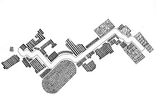
When I walk from Cowgill to Mish Mish I notice a variety of things; mainly academic buildings, the aroma of food, landscaped areas, construction sites and shopping areas. My first attempt to depict this experience was very literal. I drew the areas I passed as their actual shapes. However, as I continued working on this project I realized that on my walk, I did not even notice the actual shape of the areas, I simply just recognized what I passed. So, I extended the patterns of the areas to depict my experience more accurately.
Then I created an entirely different map. This map represents natural densities. In other words, people, vegetation, animals, essentially anything living is expressed with circles. The larger the circles, the more dense the natural elements. Since I was blending all natural densities, I chose to stick to the one color that was most prominent on my walk.


.jpg)
No comments:
Post a Comment